With pubs - like 'The Sally' (see previous post) - closing at an alarming rate across the country, it's reassuring when a new establishment appears in the locale, especially when it's one as good as Durham's first 'micropub', The Station House, which opened in December 2015 at 43 North Road (NGR NZ 26902 42677). Previously the premises of the interior design business, Middleton Design, this is the unusual triangular corner property at the angle of North Road and Station Approach. Situated immediately north-west of the railway viaduct, it's a property which is very much in the shadow of the city's most prominent industrial era monument.
 |
| View of The Station House micropub at the angle of Station Approach and North Road, with Station Approach (part of Castle Chare before the viaduct was built) to the left of view, passing through an arch of the railway viaduct and winding up to the current railway station. Both the station and viaduct were built on a branch railway line (which opened in 1857) from Bishop Auckland, rather than on the early 'main line' through County Durham; note that the pub's hanging sign had yet to be painted (photograph taken March 2016). |
I remembered that, before the aforementioned interior design business, this property had at one time been a newsagent's corner shop, while a dimmer recollection was that at least part of it may have been a hairdressers. When you can't quite remember things like this, often the best place to look is the fantastic series of volumes of historic photographs that Michael Richardson has compiled over the years as part of the Gilesgate Archive project (see introductory post). Sure enough, Durham City in Colour 1960-1970 (page 70) has a view (from 1970) taken from outside The Bridge Hotel, looking down North Road (almost exactly the same view as my photograph above). The photograph caption notes how the property (or perhaps more accurately, its main two-storey portion) was at that time 'Telfer's', a tobacconist and fishing tackle manufacturer, a business which later moved across Durham to Claypath. It was presumably sometime later that this part of the property became the newsagent's shop that I remember.
As for the hairdressers, the answer came from the Durham Photographic Society's Durham Then & Now volume, which compares (page 25) photographs of similar views down North Road from c. 1970 and 1999. The later of these photographs confirmed my suspicion that what is now the single-storey south-eastern outshut part of the property had indeed been a hairdressers, with its sign 'David's Hair Stylist' encroaching onto the main building. Interestingly, the c. 1970 photograph indicates that the same business occupied that part of the property, as well as an adjacent single-storey building standing directly below the line of the viaduct, backing onto one its piers; then with a more extensive frontage, the business also had a different and longer sign, 'David's Modern Hair Stylist'. It was the construction of the North Road roundabout in c. 1970 which necessitated demolition of the main part of the hairdressers, directly beneath the viaduct, along with two adjacent buildings further down North Road (to the south-east), the south-easternmost being an imposing three-storey Sam Smith's pub, The Station Hotel (as opposed to The Station House). The existing end wall of the outshut (comprising 'modern' brickwork) was presumably built following demolition of the main part of the hairdressers.
But what about the date of origin of the main part(s) of the Station House building? Although the property is now part-rendered and mostly over-painted, some clues to its date of origin remain in the structural fabric. The unpainted brickwork visible in the south-eastern gable end looks, broadly, to be of 'late 18th- or early to mid 19th-century' date, so the building can be perhaps broadly dated as 'late Georgian'. Such a date would not be out of place, as Durham certainly has many brick houses of the Georgian era on its older streets, for example the Baileys, South Street, Crossgate and Old Elvet.
What about looking at historic mapping and illustrations in an attempt to date the building or at least illuminate some of its historical development? The 1838/39 Tithe map of 'Framwellgate township' (below, Durham University Library Archives and Special Collections reference DDR/EA/TTH/1/101) demonstrates that The Station House plot was already developed in the earliest years of the Victorian era, some 20 years before a railway line was brought into the city centre. As far as you can make out on the Tithe map, there is certainly a suggestion that more than one, possibly three, adjoining buildings stood at the angle of 'New Road' (North Road) and 'Castle Chair' (Castle Chare). While the corner of the north-westernmost building is depicted with a 'pointed' end, this may not have been an entirely accurate representation of its form. The angle of North Road and Castle Chare had been created when North Road was built in 1831 to improve the 'Great North Road' (Framwellgate was previously the only route out northwards out of the city), hence its naming as 'New Road'.
An illustration (below) from the early 1840s, by the architect/painter Robert William Billings, appears to depict a building, recognisable by its distinctive straight, narrow corner end on the Station House plot. As depicted, the first floor window looks to be a six-over-six sash (i.e. six small panes in each of the sliding upper and lower parts of the lower window), while the ground floor window, from the small portion that can be discerned, may be the same; the six-over-six sash is of course a quintessentially Georgian feature of residential architecture.
Several photographs, thought to be some of the earliest of Durham, were taken c. 1855 while the railway viaduct was under construction; those looking down North Road (including one below from c. 1855) appear to show the same building on the Station House plot as depicted by R.W. Billings in the 1840s. The first floor window in the end of the building has at least six upper lights, but it's not clear if this is part of a six-over-six sash, and the ground floor window is not visible at all.
The first edition Ordnance Survey map of c. 1860 (below), shows the railway viaduct and station in place. Immediately adjacent to and north-west of the viaduct, in the angle of North Road and what was by then the sloping approach road to the station, is the Station House plot. This map indicates that the plot was evidently occupied by a single, triangular property with, in similar fashion to the existing building, a narrow, straight corner end to the north-west.
Thus, the maps and illustrations discussed so far do not appear to provide any strong evidence to indicate that the building depicted up to c. 1860 does not form some, if not the majority, of the structural fabric of the current property. The postulated late Georgian origin for the main part of the Station House building could, therefore, be correct.
Mapping after the first edition Ordnance Survey provides evidence of modifications to the property undertaken in the second half of the 19th century and first quarter of the 20th century. By the second edition Ordnance Survey map in the mid 1890s (below), two separate structural additions had been added at the south-eastern end of the property. These may have possibly continued below the line of the viaduct, although they do not appear to have joined-up with 'block' of two properties which stood south-east of the viaduct on North Road (one of these being The Station Hotel pub).
What about looking at historic mapping and illustrations in an attempt to date the building or at least illuminate some of its historical development? The 1838/39 Tithe map of 'Framwellgate township' (below, Durham University Library Archives and Special Collections reference DDR/EA/TTH/1/101) demonstrates that The Station House plot was already developed in the earliest years of the Victorian era, some 20 years before a railway line was brought into the city centre. As far as you can make out on the Tithe map, there is certainly a suggestion that more than one, possibly three, adjoining buildings stood at the angle of 'New Road' (North Road) and 'Castle Chair' (Castle Chare). While the corner of the north-westernmost building is depicted with a 'pointed' end, this may not have been an entirely accurate representation of its form. The angle of North Road and Castle Chare had been created when North Road was built in 1831 to improve the 'Great North Road' (Framwellgate was previously the only route out northwards out of the city), hence its naming as 'New Road'.
 |
| Extract from the 1838/39 Tithe map of Framwellgate township (not aligned north-south). The area of the Station House plot, circled red, is located in the angle of 'New Road', now North Road, and 'Castle Chair', the westernmost part of which survives today as Station Approach. The eastern part of 'Castle Chair', now Castle Chare, lies beyond the cutting for the road that now links NorthRoad roundabout and Milburngate Bridge, all these being modern era features. |
An illustration (below) from the early 1840s, by the architect/painter Robert William Billings, appears to depict a building, recognisable by its distinctive straight, narrow corner end on the Station House plot. As depicted, the first floor window looks to be a six-over-six sash (i.e. six small panes in each of the sliding upper and lower parts of the lower window), while the ground floor window, from the small portion that can be discerned, may be the same; the six-over-six sash is of course a quintessentially Georgian feature of residential architecture.
 |
Extract from an illustration by Robert William Billings (1813-1874), looking down
North Road towards the Castle and Cathedral from Illustrations of the Architectural Antiquities of the County of Durham (1846). The building depicted with the narrow corner end, with ground and first floor windows, 'behind' (left of) the wagon approaching the viewer, appears to occupy the Station House plot. |
Several photographs, thought to be some of the earliest of Durham, were taken c. 1855 while the railway viaduct was under construction; those looking down North Road (including one below from c. 1855) appear to show the same building on the Station House plot as depicted by R.W. Billings in the 1840s. The first floor window in the end of the building has at least six upper lights, but it's not clear if this is part of a six-over-six sash, and the ground floor window is not visible at all.
 |
Very early photograph of Durham, from c. 1855, with the railway viaduct in the early stages
of its construction. This evidently shows the same building on The Station House plot as R.W. Billings had depicted on his earlier illustration. The building to the right of view is The Bridge Hotel, minus its roof and undergoing development at the time (the existing building has an additional storey in brick). |
The first edition Ordnance Survey map of c. 1860 (below), shows the railway viaduct and station in place. Immediately adjacent to and north-west of the viaduct, in the angle of North Road and what was by then the sloping approach road to the station, is the Station House plot. This map indicates that the plot was evidently occupied by a single, triangular property with, in similar fashion to the existing building, a narrow, straight corner end to the north-west.
 |
Extract from the first edition Ordnance Survey map of c. 1860. Built c. 1855-57, the
railway viaduct and station are shown, along with the property on the Station House plot (circled red), immediately north-west of the line of the viaduct. South-east of the viaduct, on the same side of North Road, is a detached building, possibly 'Hylton House' (this may be the end building of the set-back row). On the other side of the road is The Bridge Hotel. |
Thus, the maps and illustrations discussed so far do not appear to provide any strong evidence to indicate that the building depicted up to c. 1860 does not form some, if not the majority, of the structural fabric of the current property. The postulated late Georgian origin for the main part of the Station House building could, therefore, be correct.
Mapping after the first edition Ordnance Survey provides evidence of modifications to the property undertaken in the second half of the 19th century and first quarter of the 20th century. By the second edition Ordnance Survey map in the mid 1890s (below), two separate structural additions had been added at the south-eastern end of the property. These may have possibly continued below the line of the viaduct, although they do not appear to have joined-up with 'block' of two properties which stood south-east of the viaduct on North Road (one of these being The Station Hotel pub).
 |
| Extract from the second edition Ordnance Survey map of 1896. The Station House plot, circled red, is evidently occupied, as on the first edition, by a single triangular property, with two separate structural additions having been added at its south-eastern end. These may have continued below the line of the viaduct, but this is not certain and they certainly do not join up with the properties south-east of the viaduct on North Road, one of which was The Station Hotel pub (P.H.). |
With the current property part-rendered and mostly over-painted, the 1970 photograph of 'Telfer's' is particularly useful as it shows the unpainted frontage brickwork and the sandstone window cills and heads, the latter formed by voussoirs in flat arches. In addition, structural details can be discerned which are no longer obvious or indeed, evident at all. Firstly though, what is abundantly clear from the 1970 photograph is that, although Telfer's occupied essentially the same building as The Station House (with the exception of the eastern outshut), the shop encompassed what had evidently been two distinct, although physically joined, properties. This is supported by the third edition Ordnance Survey map of 1919 (below), which indicates that, by that date, the main building on the plot had been sub-divided into two parts, possibly to create two shops. Whether or not the building had always had two parts is not clear; there are no indications of this having been the case in the mapping so far discussed.
 |
| Extract from the third edition Ordnance Survey map of 1919. In a variation from the previous editions, the main building on the Station House plot, circled red, is depicted as having been sub-divided into two parts, probably two shops. Another small building had been added east of the line of the viaduct, set back from the frontage, so that all the buildings in the 'block' may then have been joined. |
Certainly, by 1970, the shop front of Telfer's straddled two amalgamated properties, with a roughly central doorway, as remains the case in The Station House, where the front door crosses the junction of the two parts. Another doorway, evident at the south-eastern end of the frontage of Telfer's, has since been bricked-up and is no longer evident at all in the over-painted frontage brickwork of The Station House (although it is obvious where it was from the interior).
It is perhaps reasonable to assume that at one time, probably after the pre-1919 sub-division, the two parts of the current building may have existed as two separate shops, presumably each with its own shop front and adjacent doorway to the south-east. I thought about looking closely at the 19th- and early 20th-century trade directories to see if this could shed any light on whether or not two distinct shops or businesses did indeed ever operate in the main, two-storey part of the current building. The problem is, I don't trust the numbering, both current and historic, of the buildings on North Road. For example, The Station House is 43 North Road, while on the opposite side of the road, Domino's Pizza (in three separate buildings) is 41-43 North Road. Next door to Domino's, The Bridge Hotel is, and seems to have always been, No. 40 and I assume that is probably the (modern?) origin of the numbering for Domino's. This probably suggests that it is safe to assume that No. 43 was, historically, at least one of the buildings on the Station House plot; certainly the now-demolished Station Hotel, which was 'two doors down', was seemingly always No. 45, at least according to the 19th- century directories that I looked at. In these, a shoe-maker, John Merchant, was evidently a long-term occupant of No. 43 during most of the second half of the 19th century, while, by 1914, a Miss Katharine Walsh evidently ran a sweet shop at No. 43. That, however, is as far as I want to take that source of information, for the reason outlined, at least for the moment.
It is perhaps reasonable to assume that at one time, probably after the pre-1919 sub-division, the two parts of the current building may have existed as two separate shops, presumably each with its own shop front and adjacent doorway to the south-east. I thought about looking closely at the 19th- and early 20th-century trade directories to see if this could shed any light on whether or not two distinct shops or businesses did indeed ever operate in the main, two-storey part of the current building. The problem is, I don't trust the numbering, both current and historic, of the buildings on North Road. For example, The Station House is 43 North Road, while on the opposite side of the road, Domino's Pizza (in three separate buildings) is 41-43 North Road. Next door to Domino's, The Bridge Hotel is, and seems to have always been, No. 40 and I assume that is probably the (modern?) origin of the numbering for Domino's. This probably suggests that it is safe to assume that No. 43 was, historically, at least one of the buildings on the Station House plot; certainly the now-demolished Station Hotel, which was 'two doors down', was seemingly always No. 45, at least according to the 19th- century directories that I looked at. In these, a shoe-maker, John Merchant, was evidently a long-term occupant of No. 43 during most of the second half of the 19th century, while, by 1914, a Miss Katharine Walsh evidently ran a sweet shop at No. 43. That, however, is as far as I want to take that source of information, for the reason outlined, at least for the moment.
A couple of other things are worthy of note having looked at both the 1970 photograph of the two amalgamated shops which formed Telfer's at the time and the current standing building. The first is that in the street frontage elevation, there are the remains of two stacks of quoins, one on the ground floor of the north-western part (or shop) (but not at the end corner and not rising to the full height of the floor), the other in the first floor of the south-eastern part (or shop). The location of the quoin stack in the north-western part, as well as the fact that its 'teeth' are to the north-west, could indicate that the corner end of the building may be the remains of a now mostly demolished building that previously continued to the north-west. If true, this may indicate that that building (or at least most of it) met is demise when 'Castle Chair' (Castle Chare) was built to join up with North Road. The presence of the quoin stack in the first floor of the south-eastern part could indicate that this was once the exposed corner of that building and, indeed, the presence of both quoin stacks may indicate that the north-western part of the current building, or at least the part between the two quoins stacks, is actually an 'infill' between two earlier buildings.
Of course, while little or none of this supposition is supported by the map evidence, that doesn't necessarily mean it is incorrect. I don't have any idea what was on the plot before the Tithe map, and with around 10 years between that and the first edition Ordnance Survey map, then around 40 years between the first and second editions of the Ordnance Survey map and then more than 20 years between the second and third editions, there is plenty of scope for episodes of development to have occurred which are not apparent from the map evidence. Also, I don't know if Castle Chare was built prior to, contemporary with, or subsequent to North Road, and only the last of these would really allow for most of a former building to the north-west to have been demolished so that just its corner end survived, now amalgamated into the narrow corner end of the existing building.
The second thing of note that is obvious by comparing the 1970 photograph of Telfer's and the current building is that the ground floor window in the narrow corner end has been bricked-up since 1970. This is unfortunate, as the window had an ornate stone surround which seems to have been partly removed. In contrast though, the first floor end window on the frontage was already bricked-up in 1970, and this feature may be able to provide some evidence for a date of construction of some (or most) of the building.
The bricked-up window in the first floor of the frontage likely means one of two things. Firstly, one version of the infamous Window Tax, administered over 150 years between the late 17th century and the mid 19th century (very little well-researched information appears to be available online about the Window Tax, but Andrew Glantz's superb 2008 paper looks the ticket; Glantz includes references to other important secondary sources on the subject). The Window Tax was first imposed in 1696, during the reign of William III, to finance what was known as the 'Great Recoinage', in essence the replacement of old hammered coins, that had become very worn and been repeatedly clipped, with new milled coins. Always a banded tax, based on the number of windows in a house, the Window Tax saw several modifications before being finally repealed in 1851; some adjustments were linked to military campaigns, such as in 1758 and 1761 when the rates were increased to help fund the Seven Years War. As Glantz succinctly puts it "The tax code reached its highest degree of complexity in 1808 under Spencer Perceval" (Perceval is perhaps most famous for being the only British Prime Minister to have been assassinated; the culprit was a disgruntled businessman, John Bellingham, but the reason was nothing to do with the labyrinthine version of the Window Tax which came in under Perceval). In summary, the 1808 version of the Window Tax saw the lowest band for taxation being six windows (therefore houses with less than six were exempt). A subsequent adjustment, in 1825, saw all houses with less than seven windows become exempt.
Either of these versions of the Window Tax from the first decades of the 19th century could, potentially, have been the cause of the first floor frontage window in the property being bricked-up. There is, however, the complication that we don't know how many windows the house/shop that had its window bricked-up actually had, not least because of the waters being rather muddied by the possibility just raised that this part of the building may have been a later 'infill'. For it's worth, as far as you can make out in the 1970 photograph, the brickwork in the blocked first floor window of Telfer's looks very similar to that of the main fabric, which may suggest that the bricking-up took place fairly soon after construction. Therefore, if either of the 1808 or 1825 versions of the Window Tax was indeed the reason for the bricking-up, a late Georgian, potentially Regency, date of construction is possible.
As to the second possible reason behind the bricking-up of the window in the first floor of the frontage of the building, it may simply have been a design feature. While so-called 'blind' windows were a fairly common feature of residential Georgian architecture, the technique was mostly employed as an element of design, in simple terms, for the purpose of 'symmetry', which is perhaps difficult to see in this particular instance.
Other things of note that have happened to the property since the 1970s include: it has lost two brick chimneys to the rear, with just one remaining; a small window under the eaves of the south-eastern gable end has been blocked, and; all the original sash windows in the first floor have been replaced in uPVC. The current main shop front windows have been installed as part of the refit for the micropub, and very nice they are too.
Today, the bricked-up ground floor window in the narrow corner end of The Station House has a small sign to the railway station on it, one that is rather more subtle than the huge 'TO RAILWAY STATION' sign once affixed to the viaduct pier on Station Approach, as shown on another photograph, this from c. 1969, in Durham City in Colour 1960-1970 (page 71).
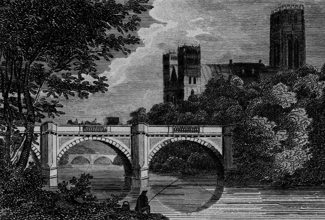
As mentioned, The Station House lies immediately adjacent to Durham's Grade II-listed (List Entry 1322851) railway viaduct. This monumental structure, comprising 11 semi-circular arches each approximately 18m wide and 23m high, is generally thought to have been designed by Thomas Elliot Harrison (1808-1888), engineer-in-chief of the North Eastern Railway (formed 1854), likely working in collaboration with engineer/contractor Richard Cail (1812-1893). It was built in the 1850s, along with the current railway station, then the terminus of a branch line from Bishop Auckland which opened in 1857. Durham's first station (in the city, there was an earlier one in Shincliffe) was the one on Gilesgate, that being the terminus of a branch line from Belmont on the Darlington to Gateshead line via Leamside, this being essentially the original ‘East Coast’ main line built in the early 1840s. The current railway station did not become part of the new (and current) main line until, firstly, it was linked, near Newton Hall, to a line from Newcastle along the Team Valley in the late 1860s, then, secondly, when it was linked in the early 1870s by a new line laid to the south from Relly Junction, near Neville's Cross, which joined the original main line at Tursdale, north of Ferryhill.
 |
| View looking roughly south-west along the north side of Durham's railway viaduct, taken from outside The Station House. Note the brick arch soffits contrasting with the sandstone piers and abutments. The brick gable end to the right of view is that of 36 North Road, now Partners hairdressers (photograph taken March 2016). |
I understand that a second micropub is soon to open in Durham, this one on the north-bound platform of the railway station itself. Let's hope the new venue is as good as The Station House, which is well worth a visit if you like great real ale and/or cider and a friendly welcome. Whether or not the historical development of that premises is quite as complicated as The Station House's seems to be remains to be seen.